Canadian Dream Trails - Trail running in the Canadian Rocky Mountain Parks (UNESCO World Heritage) and races around -
In 1983, Canada nominated their Rocky Mountain national parks Banff, Jasper, Kootenay and Yoho for inclusion on the UNESCO list of World Heritage Sites
because of the areas “exceptional natural beauty”, habitats of rare and endangered species” and its natural landforms such as mountain peaks, glaciers, lakes, canyons, limestone caves…”
That already sounds pretty amazing and like a perfect place for trail running but the UNESCO World Heritage Committee requested the Canadian authorities to consider also the surrounding
provincial parks of Mount Robson, Hamber, Mount Assiniboine and Kananaskis – an even bigger area to explore. In 1984, the Committee welcomed the proposal and declared the parks (excluding
Kananaskis) as a world Heritage, so it consists of in total seven parks (4 national parks and 3 provincial parks) and an amazing wide naturally, wild trail system.
The only problem you have as a trail runner is basically the enormous variety of choices! However, each park is different and has his own character so you
should try to explore them all.
Solution? Each park (except Hamber?) has at least one long famous multi-day hike which is runnable in one day and gives a small
impression of the park. We thought it’s a good idea to run and present this trails and our experience to make you dreaming and run them too at some time.
Jasper: Skyline trail. A 46 km long scenic trail from Maligne
Canyon to Maligne Lake or the other way around – mostly above the tree line with a scenic view along the trail.
Banff: Skoki is a 39 km long trail round close to Lake Louise but
way less crowded.
Kootenay: Rockwall is a very diverse 55 km long run on pretty
small and rocky trails.
Yoho: The Iceline is a shorter 21 km but not less scenic run, mostly on
rocky surface. If you are doing it as a loop it’s going back in the forest and is passing some spectacular waterfalls as well.
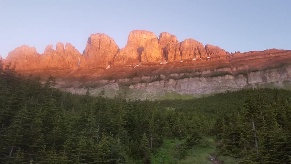
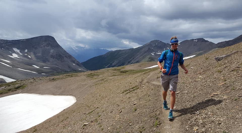
Jasper Skyline Trail (Jasper NP):
I did run this famous and beautiful trail as part of my Canadian Rocky Ironman, because with a length of 44 km it fits pretty good as a marathon. Except of the
beginning and the end it’s above the tree line and has a fantastic view over the surrounding mountains. It’s easily accessible, because it’s close to Jasper, the Maligne Canyon and the Maligne
Lake. The only problem is, that it is for quite some time under snow and just runnable in the summer period.
However, you have two options to run it. From the Canyon to the Lake or the other way around. Cause I was alone and it was logistically and safer to find a hitchhike to the Lake and park my bike
closer to Jasper I decided to run it from the Lake to the Canyon which also means a little bit less total elevation and a fun 3 km downhill at the end.
Anyways, the highlight of this trail for me and most of the other visitors is the Notch in the middle of the trail and with an altitude of 2,480 m the highest point of the trail with a fantastic
view. I really enjoyed this trail and even after my Ironman with quite exhausting bike rides and a cold the days before it wasn’t exhausting at all and just pure fun. I met a lot of friendly
hikers, found enough water on the trail and it is a nice flowing trail and not too technical, so just perfect.
I started pretty late around noon and finished almost in the dark around 9 pm and would suggest to start a little bit earlier. In my case, I wasn’t
sure about the weather (it was pretty dark in the morning) and it took some time to get to my start point. I also didn’t really push it hard during the run and think you can it run way
faster.
However, in the end Strava recorded 47 km and 1,486 m elevation in 8.5 hours.
Jasper Skyline Track
Skoki (Banff NP):
The Skoki loop is an around 38 km long subalpine wonderland trail. With an elevation gain of only around 800 m. It should be a really enjoyable trail close to
Lake Louise to escape the crowds. Unfortunately, I missed to run this amazing looking trail and looking for a trail report of someone else.
Rockwall (Kootenay NP):
The other NP trail I missed to run and to have come back for! Depending on the resource it’s between 52 to 58 km long with an elevation gain of almost 3000
m.
It is described as one of the harder trails and just from the description, I actually think it is the hardest from all the NP trails with some pretty technical and rocky single track trails. I
missed to do it, because I was pretty exhausted and sick after my Rocky Mountains Ironman and it also sounds logistically a little bit more complicated if you don’t have a car.
It would be really cool if someone could share his/her experience.
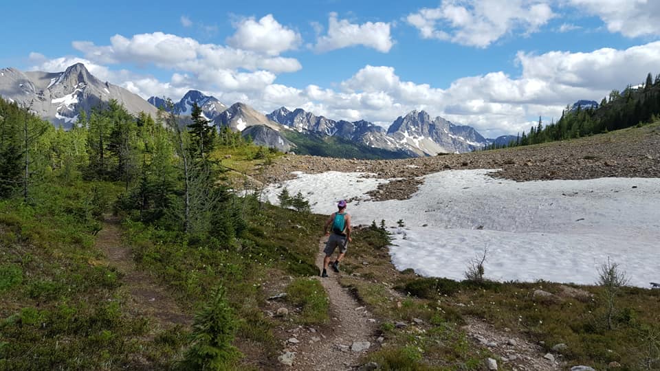
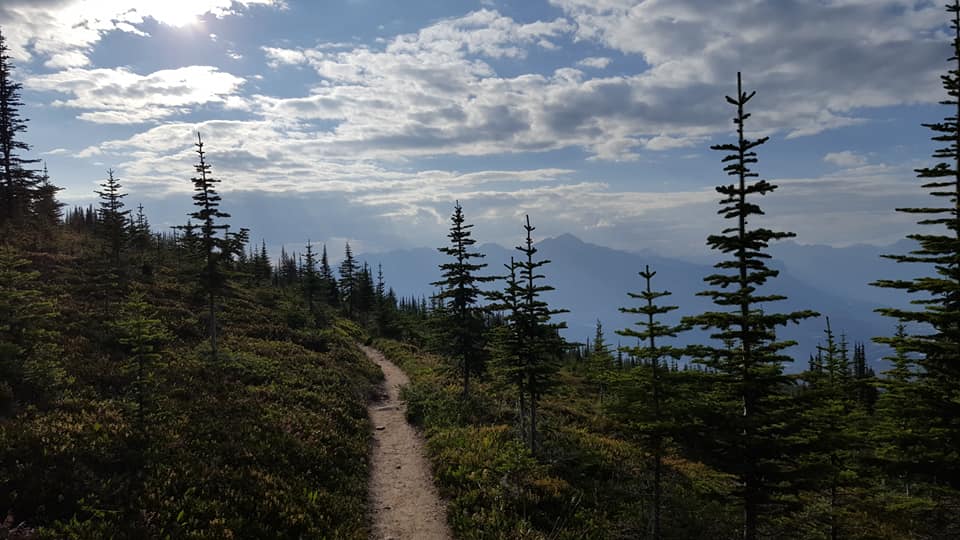
Iceline (Yoho NP):
The Iceline is probably the shortest and easiest of the runs. It’s located in the Yoho NP next to the small town of Field. If you want, you can enter it
directly from the campground next to the Takakkaw Falls, where you’re able to wake up in the morning and looking from your tent directly on an amazing waterfall which is pretty cool and a micro
adventure itself. However, I didn’t do that!
Instead my Iceline experience was kind of a chaos trip, maybe I underestimated this trail a little bit. I did the Iceline trail one week after my 70 km Mt. Assiniboine and Sinister7 run with a
friend. Expecting 20 km with 1400 m elevation, sounded pretty easy and like a short enjoyable “recover” run.
Instead, we ended up coming back at midnight hiking for around 3 hours in the dark, a bit “terrified” of bears. To be fair to the trail, I have to admit that we started pretty late, around 5 pm.
My friend had to work for Parks Canada Yoho until that time and I had no car and wasn’t really motivated to run it by myself after a lonely 7 h bike ride from Canmore to Field the day before and
sharing the trails is always more fun. Another point was that she did the trail two times already, so I had an expert on my side and she did it once in the spring and one in the summer but always
with a big backpack and was excited to do it fast and lightweight.
We parked at the Takakkaw Falls and went directly to the trail. The trail has different distance information from 12 km up to 19 km and normally just indicate the trail in one direction but of
course you also have to come back or do a loop through the valley to come back to the parking lot. That’s what we did and I would recommend.
We started with the Iceline at the parking lot which means a really steep beginning and you almost gain all your elevation on that first part. Just to find yourself above tree line and in pretty
rocky, sometimes snowfield covered areas after a while. The trail goes just all the time along the ridge shoulder with a fantastic view on the waterfall and rockwall on the other side of the
valley. To do the loop through the valley follow the (Little) Yoho Valley trail along the river. Halfway (end of the Iceline and down in the valley you will find a sweet little ACC hut if you do
a hike instead of a run definitely a wonderful point to spend a night. However, on our way back through the valley we got somehow lost and took the wrong trail to the Twin Falls and later the
Yoho Glacier trail before my friend realized that it takes definitely too long and she also never has seen this trail segment before. So, finally we ended up with a total distance of 30 km,
elevation 1,200 m and a total moving time of 5 hours (elapsed time 7 h).
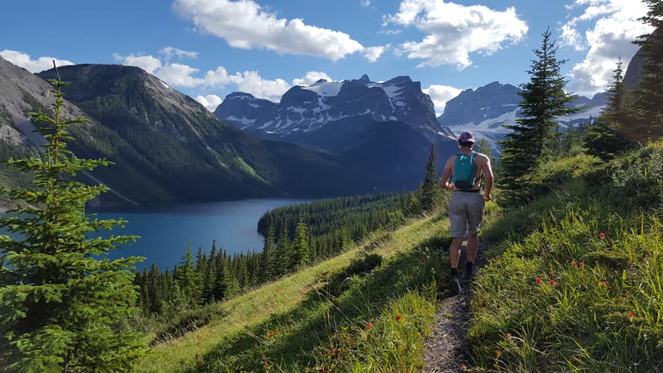
If you haven’t enough yet, the national parks are kind of extended by two beautiful provincial parks with trails which are maybe even more spectacular than the trails of the national parks.
Both parks are named by their most spectacular mountains. The Mount Assiniboine provincial park in the south and the Mount Robson Provincial Park in the north west. Both scenic trails have a
spectacular mountain-lake-glacier view destination point.
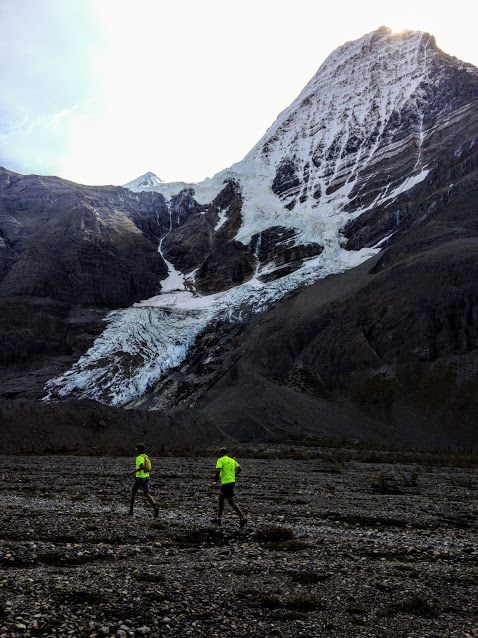
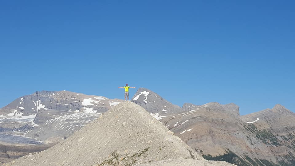
Berg Lake trail (Mount Robson provincial park):
Mount Robson is the highest peak in the Rocky Mountains and is scenicially enthroning over the turquoise blue Berg Lake and the Mist glaciers calving into it. This view alone is worth a run but combined with the scenic way to it, with some marvelous waterfalls on the way, it’s just kind of a must do for a trail runner and not for nothing rated as one of the most beautiful trails of the Explore Outdoor magazine. It’s located west of the Jasper national park and around 390 km west of Edmonton and 290 km east of Prince George.
We started our run from the last parking lot behind the visitor center mid of September and one week after the really wet
official Mount Robson marathon 2017. For me it was a special run – not only my first ultra-distance (50 km) run, but also my first really long run, since I moved around a month ago to Canada. It
was a great welcome and memorable, meeting up with a diverse group of Canadians from different towns of Alberta and BC – in total we ended up to be ten runners at the end. We got really lucky and
had a blue sky and amazing weather that day which is not common for Mt. Robson – it’s often hidden in the clouds, I heard.
Our bunch of us from Edmonton drove there a day before to sleep on the campground next to the info center. We missed a phenomenal night of northern lights, friends of the UofA Outdoors club
witnessed camping just a few km east in Jasper NP.
The first part starts on a forest road and gives a really smooth introduction in the upcoming trails before the trails goes over into singletracks passing some bridges and going along some lakes
and meandering between some forests. On the way you entering the “Valley of a Thousand Falls” with Emperor Fall just to name one highlight. Then the
trail passing some nice meadows before reaching Berg Lake (23 km, 800m elev.).
Cause we were really lucky with a sunny, warm day, we were even able to swim in the lake. After this refreshing brake our group split up and while a bunch went back, another part of us followed
the lake shoreline trail to follow a trail left up to the ridge. I highly recommend to add this loop with incredible views on Mt. Robson, and Berg Lake. Another bonus of the Berg Lake trail is
that there are only a really few really steep parts, so it’s really runnable for most parts. Almost the entire way back goes downhill and makes it easy and enjoyable to go back. The rivers and
lakes makes it easy to refill your water, in fact I not even took a water bottle with me and just drunk out of the river for the full run.
In total the run was 50.4 km with an elevation of 1,972 m it took us on a relaxed run with a lot of stops 9.30
hours (8.5 hours moving time).
Mount Robson Track
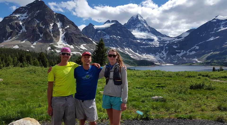
Mt. Assiniboine (Mount Assiniboine Provincial Park)
Similar to the Moun Robson trail, this trail has a real mountain highlight. By helicopter you can fly directly to the Assiniboine Lodge. However, even
better and more satisfying, is to run there. There are two possible ways. The one way trail starts at the Sunshine Lodge. Logistically easier and shorter is it to start at the Shark Mountain
trail head and do a 48 km loop over the Wonderpass to Mount Assiniboine and then just had back. The street to the Mount Shark parking lot is a not paved dirt road, just to consider that.
However, we decided to take the other route and start at the Sunshine Lodge which meant to park one car at the Shark mountain parking lot to have a safe way out after running. Stephen, Katie and
I started early, at 6 am, we went to the trailhead. Actually we started 10 km in front of the real trailhead at the first Sunshine Lodge trailhead instead of driving to the second, real
trailhead. So, in the end, we ended up with 70 km instead of the planned 58 km. The first part of the trail to Mount Assiniboine was already beautiful but the second part after the Wonder Pass,
so the Shark Mountain part along Marvel Lake is just astonishing and one of the best trail runs I have ever experienced.
We did run pretty relaxed with a lot of breaks and it took us almost 15 hours for the 70 km and recorded 2,404 elevation gain, which seems a little bit too much. The total running time was around
13 hours. Don’t forget a second pair of underpants to realize a refreshing swim in the Mt. Assiniboine Glacier Lake. Fun story: My friend Stephen took two packs of Bagels and Peanut butter with
him – not sure if that is the best solution for trail running food but…
Mount Assiniboine Track
Another famous trail in the Canadian Rockies is for sure the 1,130 km long Great Divide trail along the British Columbia and Alberta border but that is a total other story than a easy day
run 😉.
Apart of that there are a lot of other trails and some pretty nice organized ultra races in
the Canadian Rockies which shouldn’t be a secret. Still, if you are visiting them, you will mostly meet Canadians, which is probably good because Canadians are always super friendly, so take it
as your advantage for a great experience.
Ultra races:
MEC already concluded the most important races in this list, but they’re for all Canada – not only the Rockies.
https://www.mec.ca/en/article/19-canadian-trail-races-to-add-to-your-bucket-list
River Valley Revenge (RVR
Edmonton):
Even if this race is not really in the Rockies but in Edmonton it’s organized by my trail running team while I have been in Edmonton. The River Valley is beautiful with some challenging trails
and it’s just organized with so much love, so the perfect start race to enter the Rockies
Sinister7:
The Sinister 7 race was the only race I kind of joined. Even if only as a part of a crew for my
friends Nitin and Aniket who were both running the 100 Miles. The race is in the south of Alberta where I had the feeling the mountains are a little bit more smooth which you might be happy about, running a 100 miler. It’s also possible to run
the race in a Relay team. It’s consists of 7 laps. Also, cool is that it’s possible to camp in the middle of the town with the other runners. Of course, not running, I haven’t seen much of the
course but what I’ve seen looked pretty sweet, with some leg stops to get back to civilization before the runners always disappear again into the Canadian wilderness. At leg 5 I got pretty close
to get a spot and run in a relay team for another runner, who had already run some legs and got injured. I was ready and pretty stoked to run 28 km in the night. In the end another team runner
showed up and because I wasn’t registered I wasn’t allowed to run. I slept a little bit but was from now one to excited and motivated and decided I had to take the chance even I always thing it’s
kind of disrespectful to run in a race without being registered but I just couldn’t resist this time, also Leg 6 was considered to be the most beautiful and starting at 4 am I would run into a
mountainous sunrise which is just always dreamy. So, I did. That’s how I will remember Sinister 7!
The Death
Race:
125 km and 17,000 feet elevation – The death race is just another legendary Ultra Race worth to try 😉
Fat Dog:
A 120 mile, 8682 meters elevation race. Probably Canada’s hardest Ultra and suggested as a Hardrock or Western State alternative by the Trail Runners Magazine
Golden Ultra: Three Days of Pure Mountain Bliss
This list is not concluded and I'm happy to add more races – just contact me!
Or write it directly down in the Google Docs Document
DREAM: Canadian Rockies Trail fest
My dream for 2021 is a multi-day stage trail festival comparable to the Transalp or the Transrockies to experience the trails of the Rockies as a trail runner while running with new friends. However, all the trails are parts of national or provincial parks, so events in bigger size are not possible but travel tour weeks with 8-12 people are maybe a way, so if you can identify you with this idea/dream – stay in touch. I like the idea to create events not as a competition but as a great experience with friends. Running fantastic trails and sitting in the evening on a campground around a fire and talking about experiences and other trail races and plans.


Kommentar schreiben